Saturday 21 January 2012

Hartz Peak - 16th January 2012

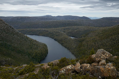
Federation Peak from Hartz - 16th January 2012
It was a quite warm day in Hobart last Monday, with a warmer day to come on Tuesday. On the way home it occurred to me that a walk in a cool breeze up a mountain would be nice, and this was just the day and time of year for it. Isaac was up for it, and we headed off directly to Hartz. We got walking around 6:15pm and got to the top at about 7:25pm. I'd had delusions about watching the sunset, but that wasn't until 8:49 according to the internet. The breeze was so cool that I needed the soft-shell and hood, and would have been hard-pressed to stay there for an hour. We didn't hang around that long, although we had head torches for a dark return trip if necessary. It was very nice to climb Hartz Peak after a day at work, and even more surprising to find there was more than enough time to do so. The views in the evening light were lovely. I didn't see much in the way of colour in the sky as sunset passed later, so I don't think we missed much by leaving.

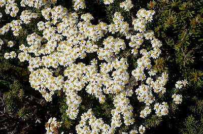
Flower (Eyebright?), Hartz Mountains - 16th January 2012

Mount Wellington - 14th January 2012

It was a cloudy day with a bit of drizzle about, but reasonably cool so not too bad for a climb up Mount Wellington. Walked to the pinnacle via the Zig Zag Track, and really enjoyed the exercise.

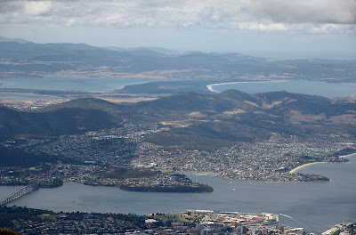
Clarence and beyond from the ZigZag Track, Mount Wellington - 14th January 2012

There were a group of people standing around on the track where it straightens out just below the big transmission tower. It became obvious they were watching something off across the hillside. I could see someone with a saxophone, and someone else with what looked like a piano-accordion. MoFo thing obviously. There were weird squeaky noises coming in snatches across the windswept hillside. Everyone was rugged up against the chilly breeze, straining to hear the "music". I decided the emperor really didn't have any clothes. Some of the people watching clearly didn't know what they'd got themselves in for. I was reminded of the old joke; What's the difference between a piano accordion and a trampoline? (Answer below) The group were revealed later in the MoFo program as West Head Project And Out Hear. When I returned, the audience had joined the players across the hillside, and the performance was winding up.

Audience and players, West Head Project And Out Hear, Mount Wellington - 14th January 2012
And the difference? You take your shoes off to jump on a trampoline.

Wednesday 11 January 2012

Mount Field National Park - 7th and 8th January 2012

Had a couple of walks again at Mount Field over the weekend. Firstly on Saturday, which was "partly cloudy" was a walk to Tarn Shelf. At least it was cool, and Tarn Shelf is always pleasant. Secondly on Sunday which dawned rainy and stayed drizzly for some time, I walked to Platypus Tarn to see what the weather would do. It stayed drizzly until I'd decided to head home, then as I neared the visitor centre the sun came out and suddenly it was 20 degrees and crowded. Never mind.

This lookout is along the winding track between the lower ski lodges and the Rodway boardwalk. Lake Seal is below, and Lake Webster just visible in the background around the edge of Mount Bridges - 7th January 2012

Lake Seal from Tarn Shelf, Mount Field East in the background - 7th January 2012

The NPWS Public Shelter, erected below the closed Sitzmark Lodge - 7th January 2012

Platypus Tarn in between showers - 8th January 2012

Pandanni flower, Richea pandanifolia - 8th January 2012

Tuesday 3 January 2012

Hartz Peak - 2nd January 2012

To round out the weekend Isaac and I went to Hartz Peak. He didn't want to get up in time to see the sunrise, so we got there a bit after 9am. It was pretty warm, and on the way down we passed a lady who seemed a bit over-heated. She said she was fine, but I suspect she was sunburnt and a little parched. Hope she enjoyed it. There were plenty of people out enjoying the fine day, and the views were pretty good - Frenchmans just visible. I think this is probably ascent number 66, have been slacking off over the last year.

Rock Daisybush, Olearia ledifolia - Hartz Mountains - 2nd January 2012

Silky Milligania, Milligania densiflora, Hartz Mountains - 2nd January 2012

Mountain Rocket, Bellendena montana, Hartz Mountains - 2nd January 2012

Mount Field East - 1st January 2012

Forest below Lake Nicholls in early morning mist, Mount Field National Park - 1st January 2012

I haven't done this walk for about 15 years I think. Last time was with my oldest son on my back, he'd have been around three, and we didn't go to the top as the wind and cold on the plateau was unpleasant that day.

Not so this last weekend, although the day dawned cloudy and drizzly at Mount Field. This walk can be started from either Lake Fenton or lower down the road at a signposted parking area, and done either as a circuit or an out-and-back from either spot. I've always started at the carpark lower down, and did so this weekend.

The walk starts with a shortish uphill stretch. A turnoff to the left signposted to Lake Fenton is passed. I honestly have no idea where this track comes out higher up, as I was unable to find an upper end to it later in the day. I will have to walk up it one day when I have the time and inclination. The right fork heads for Lake Nicholls and Mount Field East, and levels off to countour around the hill and then onto the narrow lateral moraine to the east of Lake Nicholls. There are views down to the lake here, and the track then descends slightly off the end of the moraine to the lake outlet and hut. For the first time in about four or five visits here I was rewarded with sunny views of the lake, and it is very beautiful. The forest is also pretty, and on Sunday the sunlight filtering through the soft mist and around the trees was a fine sight.

Slime mould on Lake Nicholls track - 1st January 2012

The hut has been renovated and is quite welcoming. I didn't pay any attention to whether camping is allowed in the hut, but it would certainly accommodate it from a physical point of view. There are plenty of boulders at the lake shore for sitting and enjoying a break and a snack.

Lake Nicholls, Mount Field National Park - 1st January 2012

Beyond the hut the track climbs significantly. Lake Rayner will be seen on the left, and the track then climbs across boulders and past increasing pandanni to emerge on the plateau of Windy Moor below the summit pile of Mount Field East. The cairned track climbs across boulders, occasinally steeply, to arrive at the summit which is marked by a large collapsed (demolished?) cairn. This now resembles a bowl-shaped windbreak, like the one on Hartz Peak only larger. Good views can be had from here, and in the warm sun on Sunday it was a good spot for a rest.

Waratah, Telopea truncata, Mount Field East Track - 1st January 2012

Descending to the base of the boulders again, a track heads off southwest across Windy Moor. This was quite dry, but could be a little damp underfoot after wet weather I think. the track climbs a little onto a ridge and then descends quite steeply to Lake Fenton. A sidetrack to Seagers Lookout is passed on the descent, and a sidetrip here would require an 80m re-ascent. The track emerges at the Lake Fenton mini-dam, another good spot for s rest. I looked here for a track that would take me back down to the carpark without requiring a walk down the road. There is a track which starts through a gate and passes the Lake  Fenton hut, but it emerges on the road, and I couldn't find another obvious track. The road walk is about 2.5km. I do recall a nice ranger passing a friend and I on this stretch once as the rain fell and giving us a lift in back of his ute. Not on Sunday, but the road is relatively safe with good visibility at most points, and most cars are going quite slowly.
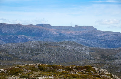
Mount Field West and Naturaliste Peak viewed from Mount Field East with Windy Moor and Newdegate Pass in between
- 1st January 2012

All in all this is a good walk, with interesting sights and good spots for breaks along the way. I took about 4.5 hrs with several stops to enjoy the lake, the peak and lunch.
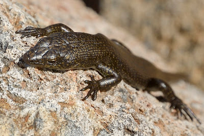
Metallic Skink, Niveoscincus metallicus (I think) - Mount Field East - 1st January 2012

Monday 2 January 2012

Tenzing Norgay at Twilight Tarn

The Twilight Tarn Hut in the Mount Field National Park contains a somewhat dilapidated set of artifacts celebrating various stages in its history. Amongst these is an old 1963 logbook page which notes the visit to the hut of Sherpa Tenzing Norgay. The photo shows the relevant entries.

1963 Logbook Entry, wall of Twilight Tarn Hut - 31st December 2011
Many years ago (1987 I think) on a winter walk around this same route (a bit of an epic through deep snow and across frozen tarns) I visited this hut with various friends. Paul Baker, Tony Morris, Lois Triffitt and I think my brother Chris were amongst them. While we were at the hut someone pointed out loudly that Sherpa Tenzing had been there. This logbook entry must have been on the wall then too. There was an older gentleman there (we were about 22/23), visiting from New Zealand. He piped up and said "I came on that walk!", which rather stunned us. As I recall he had visited at least several times to walk here, and had also been a guest of the Hobart Walking Club who were hosting the "Conqueror of Everest". We were somewhat gobsmacked at the time.

However I note also here that the book is signed above the Tenzing entry (also in 1963 although I can't tell what the dates actually are) by Royce Padman, YHA Field Officer Tas, ?NFC ?Rep, Hobart - on a visit from the Adult Education Mountaineering Camp. I think NFC is the National Fitness Council. I am wondering if this was the same trip, and maybe it wasn't a HWC trip? Anyone who can enlighten further is welcome to send information. I will have to dig through some old Tasmanian Tramps to see if there is any mention of the Tenzing visit. I recall that Sir Edmund Hillary also visited and was taken to various places by the walking club.

FURTHER INFO: It seems indeed that it was the Adult Education Board Easter Camp. There are lots of photos from Jack Thwaites' collection in the Tasmanian Archives ('Find' Tenzing at this link). I think then that the date of Royce Padman's visit is written as "Easter" 1963. Easter Sunday was apparently on 14th April that year. I've found one photo online so far, 5 rows down, second from the right on this page, showing Tenzing holding a wallaby at Mount Field. The Jack Thwaites Bush Diaries site itself is very interesting.

Twilight Tarn Hut, Mount Field National Park - 31st December 2011

Lake Webster - Tarn Shelf Circuit - 31st December 2011

After a long break, I'm going to try to catch up on the blog a bit, but in the meantime I'll put up a few very recent walks.

This circuit from Lake Dobson in the Mount Field National Park is a good solid walk with some great scenery. Starting from the carpark, head up the road towards the ski fields. After around 900m a signposted track heads downhill to the right, leading to Platypus Tarn, Lake Seal, Lake Webster and Twilight Tarn. It is around 3.5 km along here to Lake Webster. Turnoffs to Platypus Tarn and Lake Seal will be passed. Each makes a picturesque side trip, Lake Seal probably more so. The Platypus Tarn track requires a solid re-ascent. Snakes may be encountered along the way in warm weather.

Twilight Tarn Hut - 31st December 2011
The Broad River is crossed where it commences at Lake Webster, and the track then rises steadily to Twilight Tarn. Here is the old hut (day and emergency use only), which has some decaying artifacts inside, including a logbook reference to the visit of Sherpa Tenzing Norgay in 1963 (see next blog entry). In earlier days this hut and tarn hosted parties and ice skating.


Backhouse Tarn, Tarn Shelf - 31st December 2011
The track continues up the hill, passing the Twisted Tarns before arriving at Lake Newdegate. This lake lies at the northern end of Tarn Shelf. This is a quite spectacular rock shelf part way down the steep side of the Rodway Range, with many large and small tarns scattered along its length. It is well worth a visit. It is especially impressive around April when the fagus is out, but is enjoyable at any time. The track rises to the Rodway Hut over undulating terrain past numerous tarns, with spectacular views both up the hill to the Rodway Range and downhill to Lakes Webster and Seal. There are also views across the deep valley to Mount Field East. The tarns can be good for a swim on a warm day, but beware, Tasmanian tarns can be very cold even when the weather is warm.


Dracopyllum milliganii
The Rodway Hut sits at the bottom of the Rodway ski tow. Beyond the hut, the track rises then heads east on quite level ground, mainly duckboarded. At a track intersection, the left fork (not the left turn to the lookout) is probably the more picturesque, but takes a little longer as it winds amongst the boulders and snowgums to arrive at the lower ski lodges and the ski access road. (Taking the right fork will bring you to the closed Sitzmark ski lodge, which can also be worth a look. This track is a little easier.) The way then descends the steep zig-zagging ski field access road, before heading off to the right along a pleasant track which descends to the shores of Lake Dobson and returning to the carpark.


This was a good walk the other day - it was quite warm, and I was pleased to be able to get water regularly. One Tiger Snake was encountered a little below Twilight Tarn, but he was more alert than me and was leaving the track by the time I saw him. The track was quite dry, although I think at times the section in the valley can be a little wet under foot. It is about a four hour walk, although with stops and sightseeing it could take longer, and is about 13.5km.