Showing posts with label Walks. Show all posts

Thursday, 27 November 2014

Mount Field West - 19th November 2014

Wednesday 19th November was apparently quite warm in Hobart, with BoM recording 27.3 deg. It was a pleasant day at Mount Field, with the sun out all day, just requiring a jacket in the breeze at the summit. I always find this is a good solid walk. It's listed as 16km, but my GPS measured 19.9 by the end of the day. Even allowing for its inevitable meandering inaccuracies, I think it's more than 16km. I'll clean up the track sometime and see what it comes out as. Anyway, it requires a solid effort, with a good chunk of the track being bouldery and/or rough. Great views too, with much of western and south-western Tasmania visible.

I've previously put a walk description here.

Tarn Shelf - 19th November 2014

Richea scoparia, Mount Field - 19th November 2014

Mount Field West and The Watcher from K-Col - 19th November 2014

The Thumbs (front) and Clear Hill from Mount Field West - 19th November 2014

Reeds Peak from Mount Field West - 19th November 2014

Forestry operations in the Florentine Valley, from Mount Field West - 19th November 2014


Sunday, 9 February 2014

Cape Raoul - 28th December 2013

This was Cape weekend, so off to Cape Raoul the next day. Despite being generally warm, it was actually a little cloudy and breezy as I sat at the end for lunch. On the return I came across a couple of people watching an echidna. The GoPro turned out to be very useful for filming him when they left. He/she was basically unconcerned about my presence, snuffling the camera several times, and me once. The Vimeo version is edited down from the 20+ minutes I spent with him.

Cape Raoul from the lookout north of Mt Raoul. This lookout is above high cliffs, around 390m above the sea.

Looking back after crossing the shoulder of Mt Raoul and descending towards the cape.
Shipstern Bluff and Salters Point are in the background.

Mount Brown seen under clouds, across Maingon Bay from the end of Cape Raoul.

Echidna (Tachyglossus aculeatus) on the Cape Raoul Track - see following video too.


Saturday, 25 January 2014

Cape Hauy - 27th December 2013

Had a nice walk to Cape Hauy after Christmas. At least they haven't yet put the railings up at the end. Here's hoping they decide not to.

The Candlestick and Totem Pole sit between Cape Hauy (right) and The Lanterns on the left. This
view is from a Pennicott's Tasman Island Cruise Boat, and is from the north. The track ends at the
highpoint on the right, although a very steep, scrambly (and dodgy) route allows you to descend down the north
side of the cape towards the camera here.

Banksia marginata, Silver Banksia or Honeysuckle
On the Cape Hauy Track.

White Flag-Iris, Diplarrena moraea
On the Cape Hauy Track.

Cape Pillar across Munro Bight from near Cape Hauy.

Cape Pillar across Munro Bight from near Cape Hauy, The Blade and Tasman Island lighthouse easily visible.

Sunday, 19 May 2013

Mount Pillinger Walk Description

Mount Pillinger from Twin Spires
Mt Pillinger lies to the east of the Overland Track and provides spectacular views (1MB jpg) of the main peaks along that route, as well as many other peaks of the Central Plateau and northern Tasmania. This is a moderate daywalk and well worth the effort.

Times

The walk should take 2 to 2 1/2  hours one-way, but this will depend on how quickly you climb steep hills. Slower climbers should allow more time. You will also need to allow extra time for sitting on top soaking in the view.

Accessing the walk

The walk commences from the very end of the Arm River Road; the first part of the walk is along the standard walk-in to Pelion Hut. Drive to Mole Creek and then heading west out of the town take the Mersey Forest Road.  About 35 km from the middle of Mole Creek, you turn right into Maggs Road (signed to Arm River), and then after a further 2.5 km fork right into Arm River Road. Follow the road to its end. There isn't a great deal of parking - try to park so that others can too.

Safety

The summit is at 1280 m, and in poor weather the approach and climb would be unpleasant as for all Tasmanian walks, take warm and waterproof clothing. Some of the slopes are steep and bouldery, so some care is required. Mobile phones on the Telstra network operate from the higher parts of the peak.

Description

From the carpark, the track first heads through the forest and is fairly level for a short distance before climbing steeply to the plateau. Once the track has levelled out, you will come across a fork.  The main track goes right, and a more minor pad heads left.  Someone has placed some sticks across the minor track, and I'm not sure if perhaps there is a later turnoff to the Mt Pillinger walk. Anyway, you can head left, and the track undulates and winds along a pleasant valley.

The wrong cairn which does NOT
lead up Mount Pillinger
There is the opportunity to go astray along here where a misleadingly well constructed small-cairn marks an intersection with a track leading left. This track actually heads east, away from Mt Pillinger, probably back to the end of a road in the Mersey Valley I think. (See photo of the WRONG cairn.)

Keep going until you find a substantial cairn (GPS Ref. S 41 48.404 E 146 07.802) and can see a reedy lake ahead. The track now turns left and heads uphill and is easy to follow all the way to the top although some sections are steep and/or bouldery. The track first heads roughly southeast, then turns through roughly southwest before turning west and climbing steeply and more directly to the summit. The views open up, and from the top there is a very spectacular view of many of the peaks of the Overland Track and Central Plateau.

Maps

At 1:100,000 you can use either the Mersey (8114) sheet or the Cradle Mountain - Lake St Clair National park map. At 1:25,000 you will need the Rowallan (4237) and Cathedral (4236) mapsheets.

Other sources of information

The Abels Volume 1 contains a description.
John Chapman also covers this walk as a sidetrip in his Cradle Mountain - Lake St Clair Guide.

See also my post about my walk to Mount Pillinger in February 2013.

Sunday, 5 May 2013

Mt Pillinger - 12th February 2013

A nice climb to this peak with great views of so many famous Tasmanian mountains. "...I took in that view and have never stopped walking since." (P. McHugh)

Mount Pillinger is walked from the end of the Arm River Road, up the Mersey River valley behind Mole Creek. This is the same walk start as the standard walk-in to Pelion Hut on the Overland Track. Walk Description coming soon.

Having "walked around the mountains" previously, I was keen to try climbing both Mt Pillinger and Twin Spires on Cathedral Mountain. I had wondered if I might climb Mt Pillinger as a side-trip at the end of that earlier walk, but in the rain of my last day it didn't seem like a brilliant plan.

Mt Pillinger from Kia-Ora
Mt Pillinger from Kia-Ora.
Mt Pillinger is quite impressive from several places, not least down the Mersey Valley from Kia-Ora. I've seen it a few times from there, and spent some time getting a sunset photo from near the tent platforms this last time, on a beautiful evening. What a lovely prominent peak, steep cliffs, all massive dolerite, definitely seemed worth climbing, and its position suggested it would have great views from the summit.

I've found that if I want to really understand the shape of the land, I have to climb every mountain in an area several times, in various weathers and light. Then I start to understand how the hills and valleys, ridges and rivers, cliffs, peaks, creeks, lakes and forests all work together to give us the landscape. What can I see from here? How does it look from here? What shape IS that ridge I can see from over there? I've climbed the peaks of the Huon, and have started to get a three-dimensional understanding of what I can see. Mt Pillinger, and Cathedral Mountain, looked like really great places to view this spectacular area from - The Du Cane Range, the Pelions including Mount Ossa, Cathedral Mountain. I expected to see all these. In fact, when I got there, the view was indeed fit to inspire a lifetime of walking.

The walk description provides the explanation of the route. Suffice to say that I did indeed manage to find an "alternative" route, as usual, which fortunately only added about half an hour and two kilometres to my trip. I suspect my impromptu sidetrip actually heads back to a different point in the confused road network in the upper Mersey River Valley.

Mount Rogoona from Mount Pillinger
Mount Rogoona from Mount Pillinger.

Mount Rogoona is stretched out across the view when viewed from here. When it's viewed from Lake Myrtle, it's steep and prominent, the view being really along the ridge. From Pillinger we see it side-on, and can also see to the left of it the ridges which have to be crossed to climb it from the saddle. I see from here that it's no wonder it took me a while and I have a strong recollection of wandering across those misty ridges, not always sure where I was, nor exactly where the top might be. Interestingly, it's hard to pick out exactly where Lake Myrtle lies, the hills on this side of it meld into the slopes of Mount Rogoona, and perhaps it's only really visible from Mount Rogoona. From here though, I can see the forested slopes which fall away into the Mersey Valley - this is where one of my earlier "impromptu routes" headed - I think this is what is called the Jacksons Creek Track, and it heads from Lake Myrtle down to the end of the  Mersey Forest Road.

Twin Spires, Cathedral Mountain and the Du Cane Range from Mount Pillinger
Twin Spires, Cathedral Mountain and the
Du Cane Range from Mount Pillinger.
I'm headed here over the next few days, the plan being to walk up to Chalice Lake and climb Twin Spires. It's an Abel, and promises even more central views than Mount Pillinger. The cliff line from Cathedral Mountain running down the Mersey Valley is visible from here. I saw these a few weeks earlier from Lees Paddocks, from where they were mysterious imposing crags, appearing occasionally through the clouds. I'm always taken by the way 30 degree slopes seem pretty much vertical when you're looking straight up them. Even more so when you have a week's worth of food and gear on your back.

Lees Paddocks from Mount Pillinger
Lees Paddocks from
Mount Pillinger.
I walked down to Lees Paddocks a few weeks earlier in the rain, the first time I had ever visited them. From Mount Pillinger Lees Hut is easily seen, laid out in the sun. It was drizzling when I was there, but I could see cliffs high above which my new friends confirmed belonged to Mount Pillinger. I don't think I could see the summit for cloud, but given I can see Lees Paddocks from the summit, it follows that the opposite is possible!

Mount Hyperion (centre) with the south ridge of Mount Ossa (right)
Mount Hyperion (centre) with the south ridge of Mount Ossa (right).
Quite some years ago I walked out to Lake Helios at the northern end of the Labyrinth, and climbed Mount Hyperion. It's a very distinctive mountain with the impressive summit tower seen in this photo, and featured on the cover of the first volume of The Abels. You can also see it from the climb to Mount Ossa. It has some scrambling near the top, which I have to admit I had to think about as I ascended. The views from the peak were awesome, only slightly impacted by the concept of having to climb down again. Having managed that, I recall being completely unable to detect any light above my tent as thick cloud descended during the night. By morning it had cleared, and I photographed the most stupendous view of Mount Ossa and Mount Pelion East in the sunrise. They were on film, and I must see what I can do to produce better versions.

Mount Pelion East and Mount Ossa from Mount Pillinger
Mount Ossa and Mount Pelion East fill a good swathe of the view. I've only had a view from the top of Mount Ossa once, but I have a 360 degree panorama from that morning. Unfortunately it's on film, so not trivial to actually produce. I should see what I can do with it in today's software. I love the view of the sedimentary rocks below the dolerite caps here.

Mount Pelion West and Lake Ayr from Mount Pillinger
Mount Pelion West and Lake Ayr from Mount Pillinger.
I haven't climbed Mount Pelion West. I've heard it has large dark holes between vast boulders. They've made it more difficult by limiting where you can camp (legitimately) before climbing, but I suppose I'd better climb it sometime.

See the 360 degree panorama. It shows all the above views, and I think it confirms Peter's sentiments about the views from Mount Pillinger.


Sunday, 14 April 2013

Grey Mountain - 13th April 2013


Rain over Huonville from
Grey Mountain - 13th April 2013
I'm a bit out of sequence here, but I will go back and add in a couple of walks soon including Frenchmans Cap and Chalice Lake/Cathedral Mountain. Meanwhile, on a sometimes rainy Saturday, I went to Grey Mountain.

This walk commences from Van Morey Road, Margate, (see map here) and offers views of the Huon and the mountains beyond. On the strength of this, it makes it into Walk the Huon, and I've updated the walk description there. The track and mountain are within what is now known as Snug Tiers Nature Recreation Area. This appears to be a sort of reserve in which 4WD vehicles and motorcycles are allowed, but the area is protected from some things, such as the taking of firewood not being allowed. If you do this walk, you will share the tracks with 4WDs and bikes, but these are all subject to the road rules and must be registered and drivers/riders licensed. My experience yesterday tells me the rule about registration is not adhered to, but the vehicles that were there were being used sensibly. There is one well-burnt car body along the route.


Buttongrass on Snug Plains, Grey
Mountain Track - 13th April 2013
The top of Grey Mountain has a trig point and a couple of communications towers. Views normally include various close and distant peaks, but there was little to view yesterday. I had a view down to the river, Castle Forbes Bay I think, and an occasional glimpse of Collins Bonnet through the rain to the north. The walk traverses easy 4WD tracks and overall rises maybe 500m with some ups and downs. Much of the walk is across the undulating Snug Tiers with steeper climbs at the start and finish. I suspect that Spring would be a good season, with the flowers out, and a rainy autumn day was less than ideal. Nevertheless, the summit is only 831m, so on a rainy and windy day it's probably a better bet than some other places. In any case, it makes for a different view of the Huon area than those usually acquired. The walk overall is a little over 20km return, so requires some solid effort.

Saturday, 30 March 2013

Trestle Mountain - 24th January 2013

I had a very good walk to Trestle Mountain on a quite grey day. The last time I went was in May 2007, and little has changed. I've done some minor updating of the description on the Huon Walks website, so the walk description there is up to date. The most significant change seems to be that the creek I might once have thought was good to drink from seems to have a festering swamp behind a point where the track now crosses it. I think this has been caused by erosion and damming, probably by motorcycles passing through the creek. It'll probably be alright in winter when there's been enough rain to flush it out, but it wasn't looking too inviting a couple of months ago.

The Huon Valley and Huon River from Trestle Mountain - 24th January 2013

Collins Bonnet from Trestle Mountain - 24th January 2013

Now, I have increased the size of jpg files I am uploading. I'm hoping the enlarged files still fit neatly within people's browser windows, and I assume most browsers will be set to resize larger photos anyway. If any regular viewers find they can't see the pictures properly though, let me know and I may do something about it.


View Trestle Mountain in a larger map

Saturday, 23 March 2013

Pelion Hut to the Mersey Forest Road - 18th January 2013

With rain forecast after a good day out at Paddys Nut, I would have the option of climbing something else on the following day or heading straight out to the car. Now, the usual exit from Pelion is along the Arm River Track, but the car was left towards the end of the Mersey Forest Road. Advice from a friend and perusal of the maps showed that exiting via Lees Paddocks would bring me back to the road, and require only about 2.5km of walking along it to reach the car, parked as it was at the bottom of the track to Lakes Bill and Myrtle. If I did this again, I'd probably drop the pack at the end of the track to Lake Myrtle, park at the end of the Lees Paddocks Track and do the road walk at the start without the pack. Hindsight and common sense are wonderful things!

Predictably it dawned rainy. So, no mountains, and the vision of a hamburger at Deloraine formed. While the Overland Trackers headed off to Pelion Gap in full wet weather gear, I headed along the Arm River Track. I haven't used this before, so it was all new. The track is well made, and is largely duckboard. At the far end of Lake Ayr there is a remote area logbook. Here, the route to Lees Paddocks heads to the right.

As Chapman says, it heads along the edge of the button grass plain, and is easily followed. It then however becomes indistinct as it climbs onto a small ridge. As expected, I lost it. It's not a major problem, as long as you have a compass, and you can pick the approximate direction and will emerge beyond the hill and trees and can cast about for the actual track. I was keen to actually find the correct route, and ended up on the ridge wandering about in the scrub just as the rain came down most heavily, looking for the actual track over the top. In the end I gave up, took a compass bearing and emerged about 50m from where the far end of the track was marked as it entered the trees. Interestingly, I found that in the rain and mist, the forest was quite disorienting - I had trouble with directions after wandering about for a short time. So, the message is, yes, as Chapman says, the short bit of the Lees Paddocks Track over the ridge is "indistinct", and, always carry a compass!

From there the track to Lees Hut is clear. You pass Reedy Lake, and then start to descend, eventually quite steeply through lovely myrtle forest, emerging on the paddocks near Lees Hut. The hut is visible from where the track emerges. The day I was there, two gentlemen from Devonport were in residence, and generously made a cup of coffee for a soggy bushwalker. They were friends of the current lessee of the paddocks. They expected him to arrive the following day on horseback, whereupon they would all be doing some spraying for thistles. Nearby 19 head of cattle munched away.

I was directed towards the track, and had a look at the "bridge" over nearby Wurragarra Creek. This resembled a narrow sloped skating rink, with grip-giving barbed wire nailed on only the lower, and far, end of it. I waded the very low creek. The chaps at the hut had said something non-committal about "fixing" the bridge, but I think that was more about ensuring the continued attachment of the ends of the bridge to the banks of the creek.

The Lees Paddocks Track from here is obviously well known to northern walkers, and is well trodden by both them and the cattle. In a number of places the cattle have made a quagmire, but in general there's a walkway around it. I made one impromptu sidetrip when I failed to note the actual continuation of the track and instead found myself at Oxley Falls. Not realising that I wasn't on the main track any longer, I was a little bemused for some time to find that the track didn't continue beyond where the falls could be viewed. This was the last time I was "lost" on this trip, and it took me a little while to work out that I must have missed the proper route some hundreds of metres earlier. The rest of the walk was uneventful.

Saturday, 16 March 2013

Paddys Nut - 17th January 2013

Our hero magically transported himself to Pelion Hut (it would apparently be against OT rules to actually WALK there from the end of the Never Never). On the way he failed to climb magically transport himself up Mount Ossa, due to not being able to raise the enthusiasm to climb it for the fifth time while it was covered in cloud and drizzle.

From Pelion, a day walk to Paddys Nut and/or Mount Thetis appears possible, indeed, The Abels Vol. 1 says Mount Thetis is a mere 2 1/2 hours from Pelion Hut. Experience tells us, however, that their estimates seem to be for (i) very fit walkers, (ii) impervious to scrub, (iii) who know exactly where to go in untracked country. I suspect for me to get to Mount Thetis it is going to take much longer, even if I have no trouble following the route. Recent efforts suggest I will lose the track at least twice unless it is marked with large orange-painted stone bollards and a boardwalk... On this basis, I suspect I will climb Paddys Nut from the outset, and leave Mount Thetis for a time when I am set to camp up there.

The track to Paddys Nut heads left (south) from the Overland Track west of the turnoff to Old Pelion Hut. If you want more info, you can find it in books and online, including in Chapman's tome. Email me for a better description if you like. Blazes and other markers show the route heading south into the scrub. It heads uphill and is basically marked most of the way up the ridge and onto the saddle between Mount Ossa and Mount Thetis. Of course, I lost the track where a smallish tree had fallen lengthwise on the route, and headed a little left of the proper route. It's OK, as in general the track just heads upwards. This did entail a botanical excursion into a huge patch of scoparia, the fun of which was only marginally mitigated by the attractiveness of their flowers. At another point on my own personal route, I found Tasmania's largest leeches (no lie!), which basically jogged in formation up my gaiters as I perched on a fallen log to peruse the map.

The Richea scoparia was in flower, but remains a total pain to move through without a track.
There are actual track markers showing the route along the flatter part of the ridge leading up to the saddle, and these were visible maybe 100m from the midst of the scoparia thicket. Having regained the correct route, it is pretty easy to follow to a point above the actual saddle near some pools of water. Some of these pools are good for drinking, although a couple were pretty salty!

Mount Thetis from the Ossa-Thetis saddle, beyond a salty pond.
I could see Mount Osaa above me to the south from here, but to the north there was only a wall of cloud. I was pretty sure where Paddys Nut ought to be, so descended into the actual saddle, and then followed the pad towards Paddys Nut. I don't think there's a marked route up the Nut, but it's easy to head up the middle of the boulder field with some zigzags. As I did so, the cloud cleared, and a steep climb up the hill brought me to the summit. There are two bits which might be the summit, and I chose the more easterly. I think it might be slightly higher.

Mount Ossa from Paddys Nut

Views from here were great, Mount Thetis, Mount Pelion West, Mount Ossa, Mount Achilles, Perrins Bluff, and other peaks north and east. Looking at Mount Thetis, I decided I was fairly unclear where the route went, and considering the description of the boulders as "huge", I decided Paddys Nut would do for the day. Predictably I'd spent longer getting there than the Abels team reckoned I should have spent getting all the way to the top of Mount Thetis.

Paddys Nut, Mount Pelion West and Barn Bluff from the Ossa-Thetis saddle

Overall, Paddys Nut is a good sidetrip from the Overland Track, although if lots of people actually did it, then it would rapidly degrade. There are already bits which are eroded too much, and would be quite boggy in wet times.

Oh, and I lost the track at a slightly different point on the return.

Thursday, 21 February 2013

Through the Never Never - 15th January 2013

The next stage of the walk was to get to the Overland Track Hartnett Falls via the Never Never. I hadn't done this before, and in fact while checking the various suggestions online about how to walk it, I came across the view that it wasn't worth doing and just seemed to be on people's "bucket lists". Maybe! However, it still seemed interesting enough, and off I went. I had plenty of advice from various publications and online.

Junction Lake panorama, with the Mountains of Jupiter behind - 15th January 2013

From Junction Lake, the track is easy to follow around the north shore, and on to the steep descent next to Clarke Falls. The sidetrack is short and obvious, and the base of Clarke Falls is probably always cool to chilly, being hidden from the sun for much of the time. It would probably be a great hideaway on a very hot day. The track continues quite obviously from there. I did this in warm dry weather, after a dry spell. I encountered almost nothing that could be described as "scrub" and only a few short sections that resembled "mud". I suspect there are some parts of the route that flood in wet times, and this would be more tricky. There is a GPS track available online that pretty much matches the obvious pad through the entire length of the Never Never, with occasional times when the track is indistinct. Again, when the track is wetter, the route may be less obvious.

McCoy Falls, worth a look - 15th January 2013

There is a good campsite on the south side of the river, on an obvious grassy area with what amounts to a ford next to it in the river at low water. I met a large group heading east who had camped there and loved it. This is about 400m (as the currawong flies) east of McCoy Falls. they said the scrub between there and McCoy Falls, on the southern bank, was yucky, better to go further towards McCoy Falls. There are several crossing points, including one that looks like a "track". I didn't see any really good trees across the river right now for use at high water. As has been pointed out online, don't rely on trees that were reported by others. They get pushed aside or downstream. There is one nasty tree down right across the river at a high level, but it is scrawny and has lots of sticky-out limbs which will be a pig to cross. I think this was reported by one writer online. Another tree that has been identified online as previously usable appears to have moved and now has a good 8-foot gap between it's southern end and the southern bank (at very low water), through which, no doubt, a huge amount of water now flows when the river is in flood. When wet, the whole thing would be a smooth, rounded skating-rink anyway (Frank!)

The Never Never, on a nice day - 15th january 2013

The Mersey River, quite close to its source, in a dry spell - 15th January 2013

I would think most people would have to cross at points where the river is wide and low when it was flowing strongly here. I just paddled across, although predictably the river was slightly deeper than the top of my boots. There seem to be plenty of shallow crossing points in the kilometre above McCoy Falls, and in fact again above Hartnett Falls, but not having seen the river in flood here I couldn't say whether it is always or often fordable with safety.

McCoy Falls with low flow. getting to this point may be tricky
or dangerous at times of high flow - 15th January 2013

I had a good look at McCoy Falls and continued on to Hartnett Falls. Chapman says the scrub persists for most of this distance, but actually the bulk of it is an easily followed pad through myrtle forest, some buttongrass and a very small amount of scrub and occasional mud patches. Don't know what route he took.

I emerged at Hartnett Falls, and while I was trying to turn off my GPS, with which I had tried to record my route, I was accosted by some bozo who wanted to interrogate me about the battery life. Please, can I go back into the Never Never? I actually found it was relatively easy, but then this was summer, after a dry patch, on a lovely warm-but-not-too-hot summer day. People were swimming at Hartnett Falls. It was certainly worth doing. There was an enjoyable feeling of silence and remoteness in the Never Never, but I can see that if you did this on a rainy day at the end of a wet winter, the experience might be wholly different. Perhaps even more exciting, although you'd have to have the right perspective..

The view from the top of Hartnett Falls,
where people were swimming - 15th January 2013

I was advised that there is a good pad down the northern side of the Mersey to Hartnett Falls, and in fact in the myrtle forest above Hartnett Falls this looked to be the case, as seen from the southern bank. People do cross on the rock bar above Hartnett Falls, although I checked it, and it is quite slippery. I suspect it could be death-defying in high water. It is further suggested that you can continue on the north bank below Hartnett Falls, down to below Fergusson Falls, where you can cross the river on the boulder that has fallen into the gorge. It is described as "airy".

Hartnett Falls - 15th January 2013

The top of Hartnett Falls is a nice place for lunch after a sojourn in the Never Never. I took about five hours with some photography, and a couple of satisfied sits to enjoy the scenery. While I was there the ranger arrived. Curses! "You're familiar" he says. I agreed, and told him he had met me in December at Pelion Hut, where he told me off for camping on the group tentsite. He obviously worked out I hadn't been at Kia Ora, so we discussed my day's walk and possible future plans. We had a good chat about the lack of mud in the Never Never at that time. After a quiet think, he informed me that my (possible future) plans were a bit naughty in terms of the strict summer-season Overland Track rules, a fact I had wondered about. Anyway, I agreed that I would consider my movements, and he left me to it. Nuff said. I can't possibly promote my next bit of walking, so you will see me somewhat magically move to Pelion Hut, from where I will climb Paddys Nut! There may be some unexplained photographs taken from the vicinity of Kia Ora hut, at some undefined date in between... I'm wondering what I'll be doing wrong next time I see the ranger. (Greg Rubock, cover your ears.)

Saturday, 16 February 2013

Lake Artemis and the Mountains of Jupiter - 14th January 2013

From Junction Lake the plan was to walk to Lake Artemis, then climb onto the Mountains of Jupiter. These are an "Abel", although they are basically a large plateau with multiple peaks. The highest point is actually less than a kilometre from Lake Artemis.

The Abels, Volume One describes the walk, although its description of where to head away from Lake Artemis wasn't very specific - "From a suitable point on the shores of the lake...". Mabel from Warrnambool, met at Junction Lake, reckoned the best spot was above where the little promontory sticks out into Lake Artemis.

Lake Artemis - 14th January 2013

Lake Artemis is reached by crossing the river (this is the Mersey River, although quite small at this point) behind the hut. Predictably there's a tree fallen down along the steep line the track takes up the slope, but once you've found this it is quite easy to follow to Lake Artemis. The track is quite rough in places, but not too bad. At Lake Artemis you can easily reach the shore where the track heads out onto the aforementioned promontory, and camping would be good here. In addition, I think Mabel was right, the scrub isn't too bad above the promontory, although the lowest slopes are thickest, and you need to pick a lighter spot to head off.

The Abels helpfully says to "push through the scrubby slopes", and indeed they are. The slope is generally steep, but as you get higher some rocky outcrops enable you to avoid spending the entire climb in the scrub, although you also have to find your way around the small cliffs these present. Once on top, you need to work out which is the highest point, but it is indeed the spot height on the 1:25,000 Du Cane map. This has the height as 1326m, although The Abels records it as 1320m. With a small amount of work you can find the highest point.

The views are great, and I've provided photos to show them off. The highlights are the peaks of the southern Overland Track and Lake St Clair area. Of particular interest was the view of Mount Ida and Mount Spurling.

Mount Ida seen from the Mountains of Jupiter beyond Lake Payanna,
Mount Spurling and Lake Riengeena,  a view not usually acquired.

Lakes Eros and Merope, with the Du Cane Range arrayed in the background,
as seen from the Mountains of Jupiter.
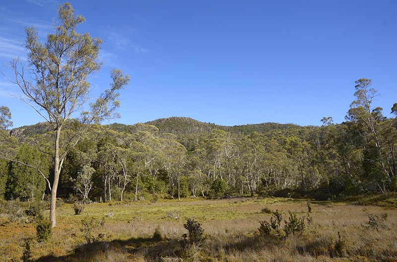
Mount Rogoona and Lake Myrtle from the Mountains of Jupiter.

Mount Gould and The Minotaur from the Mountains of Jupiter, with
(I guess) The Guardians behind.

Lake Artemis in the foreground below the Mountains of Jupiter.
Cathedral Mountain to the right, with Mount Ossa and Mount Pelion
West in the background.

And a stitched panorama taking in the views from roughly Southwest (Mount Gould) to Nor-Northwest
(Convent Hill I believe). I've got the photos for a 360-degree one as well when I find the time.