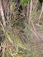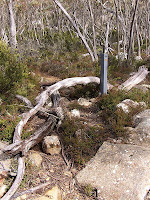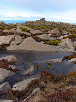
 With a forecast of 20° yesterday, a walk up Mt Wellington was in order. It did say something about strong winds as well, which turned out to be quite true. The walk yesterday was from the Springs, up the Icehouse Track, across the plateau to the summit. Then down the ZigZag Track, which was a bit icily exciting in places, and back to the Springs before extending the walk to Junction Cabin and back. The Icehouse Track climbs steeply to South Wellington from The Springs, and is named for the icehouse remains viewable in several places along its length. These were built in the 1880s to store compacted winter snow for subsequent transport into Hobart during warmer weather. (See more info.) There has been some more trackwork done since I last walked up here, with some substantial track widening undertaken. In addition, someone has also made an attempt to obscure and/or block the sidetracks to the icehouses. I'm not sure what the purpose of such an effort might be. The entry into the bottom of the lowest icehouse has been filled with cutting grass, and logs have been used as a vague sort of "track-closed" indicator/track obscurer at the top icehouse. In between but close to the lower icehouse, there's a track which may go to an old hut site, and this has also been obscured, although not very well. All a bit strange. Maybe someone intends to improve these sidetracks and remains. The lowest one could do with a bit of vegetation cleared if its actual construction is to be viewed easily. There are also two icehouses, known in 1970, which are hidden so well that I haven't yet found them.
 The walk across the plateau was livened up considerably by the accurately-forecast strong and gusty winds. These made standing upright a challenge at times - I'm sure the little tarns actually had white-caps on their surface. In the pinnacle carpark, without the wind-inhibiting friction of the plateau's boulders and low vegetation, I found that even the friction of my boots on the gravel was insufficient, and the wind was actually moving me slowly across the surface while I balanced myself against its pressure. Some smaller people were having a lot of trouble returning across the road from the viewing shelter to their vehicles. The maximum gust yesterday was 111 km/hr at 10:48am, a little short of the maximum earlier in the year (19th August) of 144 km/hr.
 The ZigZag Track still has quite a deal of snow and ice on it, and this made for a slower and more careful descent than would otherwise be required. When it's windy on the summit, the ZigZag Track is usually much more sheltered, even quite still, being in the steep bowl between the two main buttresses of the mountain. The views from here are very good over Hobart and beyond.
2 comments:
Gusting to 128kmph this afternoon!
Where can I find a photo of these ice houses?
Great photos of your walk!
Thanks Mosura. And, good question. The remains of the icehouses are difficult to photograph in their entirety now. I think I might manage a decent photo of the whole of the upper one, if I climbed a tree. (The linked photo is one of the walls.) The lowest one is amongst thick brush, and the best you can do is get pictures of the stones that make up its walls. If you mean, "where are there some photos of them when they were in use?", then I'm not sure. I'll try to find some. There might be some hidden in the archives. I've got some more info in an old Tasmanian Tramp, which I'll copy and post up sometime. They are basically thick stone walls sunk somewhat into the ground.
Post a Comment