 |
| O'Gradys Falls, Mount Wellington - 23rd May 2011 |
Sunday, 10 July 2011
Ferntree and The Springs - 23rd May 2011
The week started off with some poor weather, rain and chilly winds. This was a good opportunity to try to piece together the best walk around Ferntree and The Springs to take in the various interesting and historic sights. This sort of walk can often be done when walks further up the mountain are likely to be uncomfortable or inadvisable due to the weather. I have provided a detailed description (PDF) of a walk that takes in O'Gradys Falls, the Octopus Tree, Sphinx Rock, The Springs, Rocky Whelans Cave, Silver Falls and other items of interest, and minimises backtracking and climbing hills twice. My current plan is to put up a website with about 15 to 20 Mount Wellington walks, including a few you can't find a guide to elsewhere. This will be one of them. Feel free to print out the PDF and take the walk if you wish. The Mount Wellington Recreation Map is strongly recommended for use with this walk, and others.


Saturday, 9 July 2011
Collins Bonnet - 21st May 2011
The Saturday was a nice looking day, so I chose Collins Bonnet hoping for views into the valleys of both the Huon and Derwent, as well as some good views to the west. This walk is a good climb, and I was pleased to discover that recent weeks of much walking had greatly improved my fitness. Very nice walk from Myrtle Forest behind Collinsvale, with a chilly breeze on the summit. Only spoiling factor was the group of people on the summit who assumed that everyone else wanted to hear their attention-seeking, histrionic discussion of recent exploits. I must be getting old and crotchety.
For reference, Collins Bonnet and Trestle Mountain together are known as Sleeping Beauty in the Huon Valley. Collins Bonnet forms the hair, forehead, nose, long horsey upper lip, lower lip and weak chin, and Trestle Mountain forms the bosom. I understand the mountain has also been known as Boars back to people in the Derwent Valley.
For reference, Collins Bonnet and Trestle Mountain together are known as Sleeping Beauty in the Huon Valley. Collins Bonnet forms the hair, forehead, nose, long horsey upper lip, lower lip and weak chin, and Trestle Mountain forms the bosom. I understand the mountain has also been known as Boars back to people in the Derwent Valley.
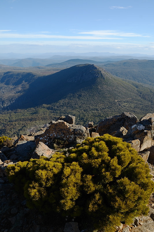 |
| Trestle Mountain from the summit of Collins Bonnet |
 |
| Trestle Mountain with Mount Weld and the Snowy Range in the distance. |
 |
| Sleeping Beauty's "nose", looking south from the summit (upper lip!) of Collins Bonnet |
 |
| New Norfolk seen from the summit of Collins Bonnet |
Sunday, 3 July 2011
Walls of Jerusalem - 16th to 19th May 2011
 |
| Westwall and King Davids Peak from Solomons Throne at sunrise |
The weather forecasts were becoming quite changeable and less reliable, so I was trying to pick a suitable window to have a few days at the Walls, aiming to get some good opportunities for climbing mountains and taking photos. I settled on a few days and headed off.
 |
| Trappers Hut, part-way up the climb to the Walls of Jerusalem |
The walk starts off forestry and hydro roads out behind Mole Creek. The carpark was previously known for car burglaries and vandalism, and there is still a sign there warning of this. I haven't heard of any problems recently. The day was slightly drizzly, but I headed off up the hill. Camping is now firmly recommended for Wild Dog Creek, rather than Solomons Jewels, inside the Walls or even Dixons Kingdom. There is a composting toilet and really good tent platforms at Wild Dog, and it takes just five minutes to walk up the hill to Herods Gate. There are also removable toilets at Dixons Kingdom, so it seems the PWS expect people to camp there. Talking to two blokes who walked in the same day as me, they had camped in a tent, and used the hut to cook in. They reckoned they were much warmer in the tent than in the hut, which was like a big fridge. Wild Dog Creek was fine for me, and it's only a little further from most of the central features than camping at Dixons.
 |
| View to the Du Cane Range from the slopes of Mount Jerusalem |
Anyway, the weather was cold and a bit damp, nightfall arriving early. Very comfortable in the tent though. Day two dawned cloudy, but not raining. Went off and climbed Mount Jerusalem via Dixons Kingdom. Views were quite good eastwards, but the Pelions and Du Canes were largely obscured by cloud to the west. Climbed The Temple as well, but the weather was basically dull without being wet.
 |
| Ice on a pond, near Lake Salome |
Day three was similar, and after some wandering around the Pool of Bethesda, I climbed Solomons Throne in the hope that the cloud would clear off while I was there. The cloud wasn't very thick, and at the summit the sun almost managed to break through and actually shine, although the wind was very chilly. Later, after some wanderings the sun did come out nicely at Dixons Kingdom for a while. After returning to Wild Dog Creek, the weather really did improve towards evening, so I headed back and climbed part way up the temple for some sunsett-y shots of the area inside the Walls. they weren't great, but the walk was very nice compared to the dull and windy walks earlier.
 |
| Sunrise across the Central Plateau's lakes, from Solomons Throne |
The next morning dawned clear, so I set off very early. After having to change my headtorch batteries by cigarette-lighter-light part-way (duuuh!), I managed to arrive at the top of Solomons Throne a few minutes before the sun rose beyond the expanse of the Central Plateau. The views all around were superb, and I started to think the trip had been worthwhile despite the three dull days to this point. A quick climb part way up The Temple affords a good clear view of the Westwall and internal Walls area. The last photo is a stitched panorama form there.
 |
| St Davids Peak, Lake Salome and Clumner Bluff from Solomons Throne |
 |
| Du Cane Range from Solomons Throne at sunrise |
 |
| Stitched panorama of The Westwall (Solomons Throne to St Davids Peak) from The Temple, early morning. |
Sunday, 22 May 2011
South Cape Bay - 14th May 2011
With a warning about dangerous surf and forecasts of eight-metre swells for Saturday 14th May, there was only one place to go: South Cape Bay. There are probably others, but walking to the bay also provides some good exercise. Never mind the attendant forecasts of rain, the seas promised some spectacular sights. In the event the weather was a bit windy and occasionally drizzly, and it was certainly chilly out on the south coast, but overall the weather wasn't too bad. The waves were spectacular too, although I'd hoped to see them washing deeply across the entire beach. The beach was quite walkable, with only the occasional large wave managing to touch the little rocky projection in the middle with a few inches of froth. I note in hindsight that the tide was actually lowest during my visit. When walking on the beach however, the waves as they broke, hundreds of metres out, were clearly higher than where I was standing. Probably what we need to make it really spectacular is eight-metre swells forecast during an actual storm. Not sure how you'd manage to take photos of it though....
 |
| South Cape Bay washed by eight-metre swells, viewed from the cliffs - 14th May 2011 |
 |
| The view between Lion Rock and Coal Bluff, South Cape Bay - 14th May 2011 |
 |
| Foam in a wave-lashed South Cape Bay - 14th May 2011 |
Mount Wellington - 10th May 2011
Walked from Ferntree heading for the summit. From the city a dusting of snow across the upper half of the mountain was visible, which often means quite deep snow across the plateau, at least deep enough to make walking uncomfortable. Having reached the Springs via Fern Glade and Radfords Track, I headed for the Icehouse Track. Near the top of this, the snow became evident. It wasn't very deep generally, but in places it would have been deep enough to make walking more difficult, except it was really firm and dry, even providing a nice grip. Made for very nice walking across the summit plateau. I met two blokes on the plateau who reported the Zig-Zag Track was really quite icy, which confirmed as best my intention to return via the Panorama Track.
Up the Icehouse to the south and down the Panorama in the north makes for a sort of "Grand Tour" of Mount Wellington. There's a bit of road walking required to use the Panorama, but on a weekday it was fairly quiet and safe. I completed the walk with a descent to Junction Cabin down Hunters Track, ascending to The Springs and finishing with the short descent back to Ferntree. Two (different) blokes at Junction Cabin had ascended via the Old Hobartians Track from Lenah Valley, and I think being an old Hobartian, I should probably do that one sometime. It has a side connection (roughly, I think) to the bottom of Lost World, which might make for an even "grander" tour.
Up the Icehouse to the south and down the Panorama in the north makes for a sort of "Grand Tour" of Mount Wellington. There's a bit of road walking required to use the Panorama, but on a weekday it was fairly quiet and safe. I completed the walk with a descent to Junction Cabin down Hunters Track, ascending to The Springs and finishing with the short descent back to Ferntree. Two (different) blokes at Junction Cabin had ascended via the Old Hobartians Track from Lenah Valley, and I think being an old Hobartian, I should probably do that one sometime. It has a side connection (roughly, I think) to the bottom of Lost World, which might make for an even "grander" tour.
 |
| Boulders on the summit plateau of Mount Wellington - 10th May 2011 |
 |
| Boulders on the summit plateau of Mount Wellington - 10th May 2011 |
Friday, 20 May 2011
Nevada Peak - 6th and 7th May 2011
In a week of variable weather, the Friday and Saturday looked like providing the best opportunity to camp at high altitude in reasonable conditions. Off to Nevada Peak for the first time since my last overnight trip there. This is however, a day walk if you wish, taking around six to eight hours depending on your route and general speed. The tarns and the alpine plateau are lovely though, and an environmentally-sensitive overnight stay at the Snowdrift Tarns is great. I have some more information about the walk here, which will direct you to email me for the complex road directions and a walk description, including details for returning via Woolleys Tarn.
I climbed to the tarns in overcast, chilly and misty conditions. The clouds seemed to consist of a huge amount of very fine, but very wet, drizzle, and I was quite chilly by the time I got to the tarns. Once in the tent and with a coffee and nibbles inside me, all was well. The drizzle persisted until dark though, with the view consisting of the inside of the cloud and a small area of foot-high alpine herbfield around the tarn. I was hopeful that the weather would remain calm at least, in high winds the plateau here is a harsh environment despite some shelter from westerly weather afforded by the mountain ridge.
Waking quite early, my first look outside suggested that the cloud remained. However, once out of the tent I realised that the peak was out of the cloud, and the sun was rising beautifully. I set off to climb Nevada Peak immediately, camera in hand. Views were great and the following photos give a taste. The views of the Anne Range are particularly fine from Nevada Peak. Having returned to the tarn for breakfast later, the clouds again closed in, and by the time I had retreated across the plateau to return to my car, the peak was only occasionally visible through swirling clouds again. In the end, it was worth the walk for the views from the peak and plateau, but I had been dubious about it on the Friday evening huddled in my tiny tent.
I climbed to the tarns in overcast, chilly and misty conditions. The clouds seemed to consist of a huge amount of very fine, but very wet, drizzle, and I was quite chilly by the time I got to the tarns. Once in the tent and with a coffee and nibbles inside me, all was well. The drizzle persisted until dark though, with the view consisting of the inside of the cloud and a small area of foot-high alpine herbfield around the tarn. I was hopeful that the weather would remain calm at least, in high winds the plateau here is a harsh environment despite some shelter from westerly weather afforded by the mountain ridge.
Waking quite early, my first look outside suggested that the cloud remained. However, once out of the tent I realised that the peak was out of the cloud, and the sun was rising beautifully. I set off to climb Nevada Peak immediately, camera in hand. Views were great and the following photos give a taste. The views of the Anne Range are particularly fine from Nevada Peak. Having returned to the tarn for breakfast later, the clouds again closed in, and by the time I had retreated across the plateau to return to my car, the peak was only occasionally visible through swirling clouds again. In the end, it was worth the walk for the views from the peak and plateau, but I had been dubious about it on the Friday evening huddled in my tiny tent.
 |
| Eastward view across the lower Snowdrift Tarn from upper slopes of Nevada Peak - 7th May 2011 |
 |
| My own personal triple-rainbow appeared just above me in the misty morning air, Nevada Peak - 7th May 2011 |
 |
| Snowy South and the upper Snowdrift Tarn from Nevada Peak summit - 7th May 2011 |
 |
| Anne Range from Nevada Peak - 7th May 2011 |
Wednesday, 11 May 2011
Mount Field West - 3rd May 2011
 |
| Mount Field West seen from the Rodway Range. K-Col Hut visible on the left - 3rd May 2011 |
With good weather forecast, at least for most places, a good mountain walk was in order. I chose Mount Field West, a walk I have always enjoyed, if always found to require a good deal of effort. The walk is 16km and requires about 750m of climbing, including the climb back over the Rodway Range on the return. A significant portion of the walk is on boulders which require care and extra effort, and once you are beyond the Tarn Shelf turnoff, the track is mostly quite rough, even where it's not on boulders. The summit plateau at Mount Field West is lovely though, and views to the west and southwest can be terrific, Florentine Valley forestry operations notwithstanding. On this day I got pretty good views for much of the day, but the cloud came in while I was at the actual peak, so no westward views this time.
Walk Description: The track is well marked for use in clear weather, but may be difficult to follow in rain and fog. Be aware that once in the vicinity of the peak, the return is over several kilometres of extremely exposed route. There are no more sheltered alternatives, although there is a very small hut at K-Col which would provide shelter in an emergency. This hut has no stove. This walk is not worth attempting in poor weather. Cloud, rain and wind should all give pause. Be prepared to alter walk plans at Lake Dobson, or even once in the vicinity of Tarn Shelf if weather conditions seem poor. You will get a taste of them on the top of the Rodway Range, and if weather there makes walking uncomfortable, be aware that this will persist for the remaining distance of the walk until you are back below the Rodways, or even until you are back below the Ski Village.
The walk commences at Lake Dobson, following the track around the lake and then quite steeply up the ski lodge access road. Where the first ski lodges are found, I prefer the walking track that passes in front of them and then winds up to the plateau through boulders and alpine gums. This emerges on the main board walk which heads along towards Tarn Shelf and the main bulk of the Rodway Range. The track again climbs quite steeply onto the Rodway Range, starting a lengthy traverse on boulders. These slow progress somewhat and require greater exertion. Being somewhat unbalanced, I always find them more awkward. The way is marked with cairns and poles and winds along the top of the range through a depression known as The Lions Den before eventually crossing to the western side and descending towards K-Col. The hut will be clearly visible a little way up the far side of the col. K-Col is so named because of the shape of the topography - the col joins the Rodway Range to the peaks of Tyenna, Florentine, Naturaliste and Field West, making a sort-of "K" on the map. The hut used to have a water tank and coal stove, but these are no more. Possibly to discourage camping, as the hut is now clearly signed as being for emergency use only. Water can be obtained a little way beyond the hut from Clemes Tarn. I don't vouch for the quality of the water, but I didn't catch anything from it.
 |
| Clemes Tarn in a misty mood - 3rd May 2011 |
 |
| Looking back towards Naturaliste Peak across the Mount Field West summit plateau, from the summit of Mount Field West - 3rd May 2011 |
Subscribe to:
Posts (Atom)