 |
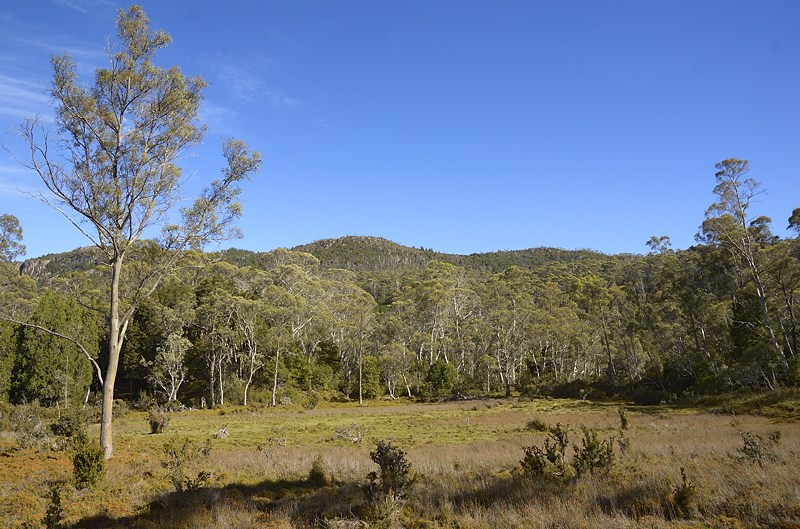
| Junction Lake panorama, with the Mountains of Jupiter behind - 15th January 2013 |
From Junction Lake, the track is easy to follow around the north shore, and on to the steep descent next to Clarke Falls. The sidetrack is short and obvious, and the base of Clarke Falls is probably always cool to chilly, being hidden from the sun for much of the time. It would probably be a great hideaway on a very hot day. The track continues quite obviously from there. I did this in warm dry weather, after a dry spell. I encountered almost nothing that could be described as "scrub" and only a few short sections that resembled "mud". I suspect there are some parts of the route that flood in wet times, and this would be more tricky. There is a GPS track available online that pretty much matches the obvious pad through the entire length of the Never Never, with occasional times when the track is indistinct. Again, when the track is wetter, the route may be less obvious.
 |
| McCoy Falls, worth a look - 15th January 2013 |
 |
| The Never Never, on a nice day - 15th january 2013 |
 |
| The Mersey River, quite close to its source, in a dry spell - 15th January 2013 |
I would think most people would have to cross at points where the river is wide and low when it was flowing strongly here. I just paddled across, although predictably the river was slightly deeper than the top of my boots. There seem to be plenty of shallow crossing points in the kilometre above McCoy Falls, and in fact again above Hartnett Falls, but not having seen the river in flood here I couldn't say whether it is always or often fordable with safety.
 |
| McCoy Falls with low flow. getting to this point may be tricky or dangerous at times of high flow - 15th January 2013 |
I had a good look at McCoy Falls and continued on to Hartnett Falls. Chapman says the scrub persists for most of this distance, but actually the bulk of it is an easily followed pad through myrtle forest, some buttongrass and a very small amount of scrub and occasional mud patches. Don't know what route he took.
I emerged at Hartnett Falls, and while I was trying to turn off my GPS, with which I had tried to record my route, I was accosted by some bozo who wanted to interrogate me about the battery life. Please, can I go back into the Never Never? I actually found it was relatively easy, but then this was summer, after a dry patch, on a lovely warm-but-not-too-hot summer day. People were swimming at Hartnett Falls. It was certainly worth doing. There was an enjoyable feeling of silence and remoteness in the Never Never, but I can see that if you did this on a rainy day at the end of a wet winter, the experience might be wholly different. Perhaps even more exciting, although you'd have to have the right perspective..
 |
| The view from the top of Hartnett Falls, where people were swimming - 15th January 2013 |
I was advised that there is a good pad down the northern side of the Mersey to Hartnett Falls, and in fact in the myrtle forest above Hartnett Falls this looked to be the case, as seen from the southern bank. People do cross on the rock bar above Hartnett Falls, although I checked it, and it is quite slippery. I suspect it could be death-defying in high water. It is further suggested that you can continue on the north bank below Hartnett Falls, down to below Fergusson Falls, where you can cross the river on the boulder that has fallen into the gorge. It is described as "airy".
 |
| Hartnett Falls - 15th January 2013 |
The top of Hartnett Falls is a nice place for lunch after a sojourn in the Never Never. I took about five hours with some photography, and a couple of satisfied sits to enjoy the scenery. While I was there the ranger arrived. Curses! "You're familiar" he says. I agreed, and told him he had met me in December at Pelion Hut, where he told me off for camping on the group tentsite. He obviously worked out I hadn't been at Kia Ora, so we discussed my day's walk and possible future plans. We had a good chat about the lack of mud in the Never Never at that time. After a quiet think, he informed me that my (possible future) plans were a bit naughty in terms of the strict summer-season Overland Track rules, a fact I had wondered about. Anyway, I agreed that I would consider my movements, and he left me to it. Nuff said. I can't possibly promote my next bit of walking, so you will see me somewhat magically move to Pelion Hut, from where I will climb Paddys Nut! There may be some unexplained photographs taken from the vicinity of Kia Ora hut, at some undefined date in between... I'm wondering what I'll be doing wrong next time I see the ranger. (Greg Rubock, cover your ears.)

No comments:
Post a Comment